Landsat Next Defined

Landsat Next Defined

Landsat Next is on the horizon—the new mission will not only ensure continuity of the longest space-based record of Earth’s land surface, it will fundamentally transform the breadth and depth of actionable information freely available to end users. Take a look at the new capabilities that will define the next Landsat mission.

Read More »

Expanding OpenET Across Amazon Basin

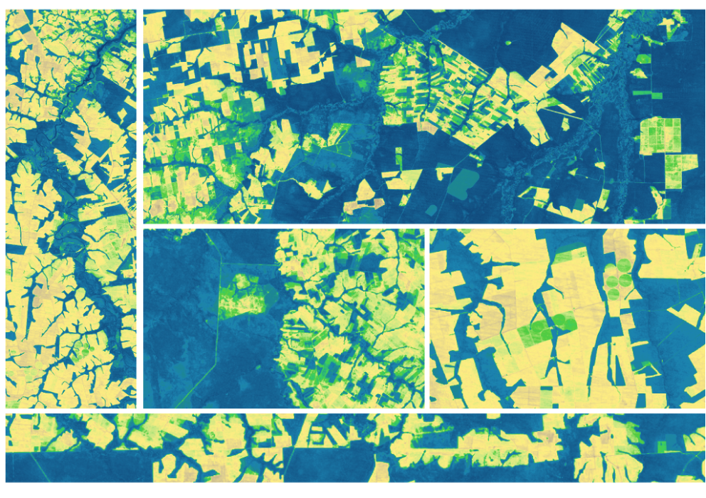
The research teams who help sustain the largest freshwater reserve in the world are developing a new tool to promote more resilient farming systems in Brazil. The goal is to help farmers better handle changes in the water cycle, deal with droughts, and adapt to a changing climate.

Read More »
Landsat Next Defined

Landsat Next Defined

Landsat Next is on the horizon—the new mission will not only ensure continuity of the longest space-based record of Earth’s land surface, it will fundamentally transform the breadth and depth of actionable information freely available to end users. Take a look at the new capabilities that will define the next Landsat mission.

Read More »

Expanding OpenET Across Amazon Basin

The research teams who help sustain the largest freshwater reserve in the world are developing a new tool to promote more resilient farming systems in Brazil. The goal is to help farmers better handle changes in the water cycle, deal with droughts, and adapt to a changing climate.

Read More »

“There is no satellite record that has the temporal reach of Landsat. While new satellite- and aircraft-based sensors are coming online with sub-meter resolution offering more and more spectral bands, none of them allow the types of temporal investigation that the combined generations of Landsat offer.”


“Landsat 8, which launched into orbit in 2013, is the newest sensor in the USGS/NASA Landsat Program — superior to its predecessors in many ways. Landsat 8 captures images with greater detail, truer colors, and at an unprecedented frequency — capturing twice as many images as Landsat 7 does every day.”


“By unleashing the power of our vast and open data resources, the Climate Data Initiative helps spark private sector innovation and will leverage resources for those on the front lines who are dealing with climate change. We are pooling into one place data from across the federal government to make it more accessible to the public and we hope our efforts will inspire other countries to follow suit.”


“It’s a fantastic time to be a user of satellite data, if you’re in that moderate resolution domain this is amazing. The Sentinels and Landsat together is going to be really a game changer. It truly is.”


“We live on this planet Earth. We all know that we want to leave this planet for our children. We know the importance of sustainability and I think that’s what Landsat’s all about. It’s about helping us manage the planet that we live on for the long-term. And that’s why it’s there and that’s why it continues to be here. And I expect it to be there for the next generation as well.”


“With Landsat we can see temperature of individual fields and how it varies from field-to-field. The temperature of the land surface gives us a good indication of how rapidly water is evaporating off that surface. And this is really important for knowing how healthy the crops are and also for supplying information for irrigators: how much water was used last week and how much do they need to replenish in the current week to keep the crops healthy.”


“The 30-year record of the Landsat sensors (i.e. TM, ETM+, and OLI) provides a unique data archive for studying the impacts of climate change on ecosystems worldwide, in our case, coastal marshes.”


“Without Landsat, ‘we would be flying blind. We need those eyes in the sky to complement our ground efforts.'”


“From now on, we’re going to be able to track all of the different types of changes in glaciers – there’s so much science to extract from the data.”


“The Landsat archive and other remote sensing systems provide the means to map and measure disturbance rates of the last 40 years.”


“Landsat 9 is really a land imaging cornerstone in guaranteeing that we’ll continue to have the types of surface measurements that we’ve had for nearly 50 years, and I think that’s significant. The user community that has developed science and application advancements around Landsat 8 will now get two observatories that are nearly identical, and we can expect to have a high-quality and reliable data stream for the next 10-plus years while Landsat continues to evolve into the future.”


“The most unique thing about Landsat is its length of record… The ability to go back 30 years or more is something you just can’t do with any other sensor.”


“I’d go to meetings and people were just jumping up and down because they had discovered another use for the data.”


“Without Landsat, ‘we would be flying blind. We need those eyes in the sky to complement our ground efforts.'”


“Landsat offers a unique continuous record of the surface of the Greenland Ice Sheet over the last 40 years, no other mission would have been able to provide observations of ice velocity change over such a long time period.”


“The USGS’s Landsat mission has an incredible 40-year record of the planet’s changing landscape, with virtually every spot imaged every eight days. It’s an incredible scientific asset.”


“This [Google Earth] update was made possible in a large part thanks to the Landsat program and its commitment to free and accessible open data. Landsat, a joint program of the USGS and NASA, has observed the Earth continuously from 1972 to the present day and offers a wealth of information on the changes to the Earth’s surface over time.”


Landsat satellite imagery is ideal for gauging vegetation cover shifts because it supplies spectral data for surface areas of about 90 square meters – fine enough to track changing spectral signal patterns across large study areas.


“From a valuation standpoint, Landsat is an extremely valuable public good just in its direct use—let alone the economic value of all the indirect uses built on the direct data.”


“Our new interface specifically uses Landsat to track flow velocity fields of Greenland’s outlet glaciers and how they have changed over time.”


“While many previous studies have reported ongoing ice shelf thinning around Antarctica since the 1990s, we didn’t previously know that a lot of it started around then.”


“When the archive was opened, there were more Landsat images outside it than in it. Many images were retained by the global network of receiving stations. An effort to consolidate these has added more than 3 million images to the repository since 2010; agreements are in place for a further 2 million to be ingested.”


“The USGS’ incredible gift of open-source [Landsat] imagery and this kind of tool are truly advancing what non-scientists can expect when it comes to views of their planet. Never before have regular people had such ready access to geographic data at this depth and quality.”


“Landsat 9 is really a land imaging cornerstone in guaranteeing that we’ll continue to have the types of surface measurements that we’ve had for nearly 50 years, and I think that’s significant. The user community that has developed science and application advancements around Landsat 8 will now get two observatories that are nearly identical, and we can expect to have a high-quality and reliable data stream for the next 10-plus years while Landsat continues to evolve into the future.”


Landsat 9 bw
Landsat 9 bw
Landsat 9 bw

The NASA/USGS Landsat Program provides the longest continuous space-based record of Earth’s land in existence. Landsat data give us information essential for making informed decisions about Earth’s resources and environment.